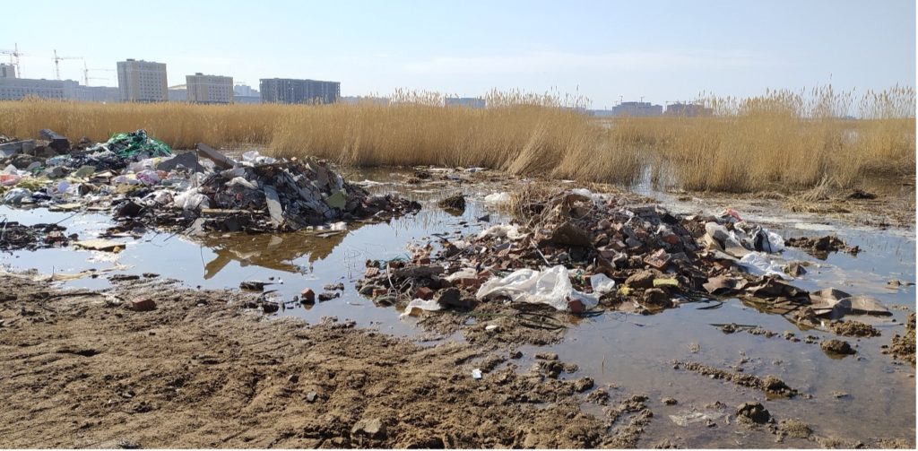
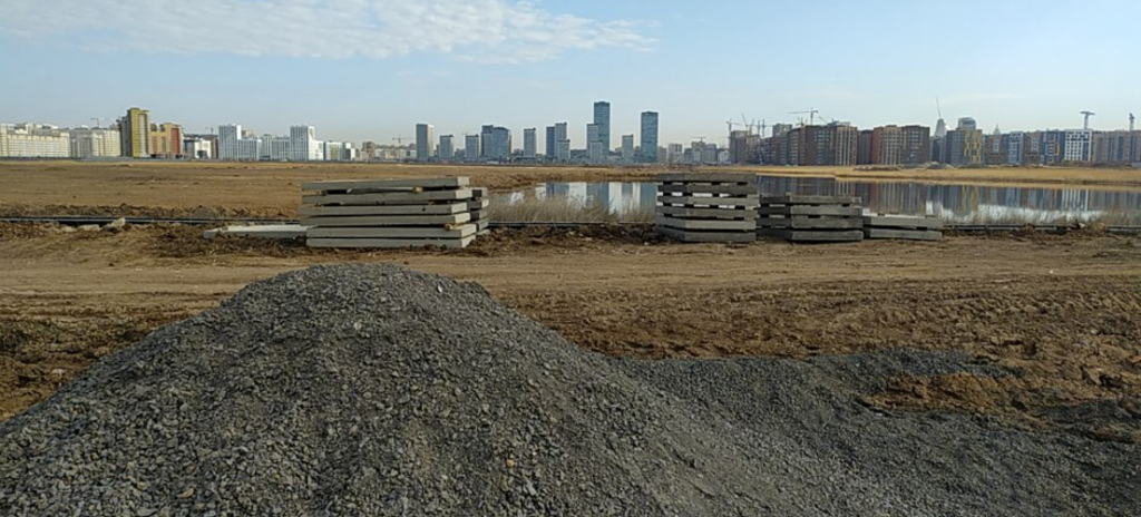
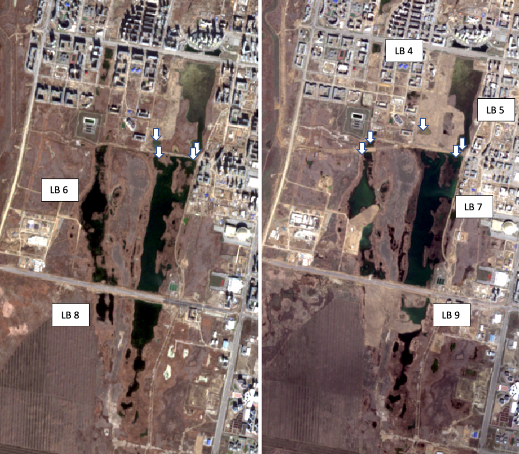
During the visit to the Small Taldykol lake system on 27th of April 2022 samples from different parts of lake system were collected for stable isotope analysis (sampling locations are shown with arrow). The current situation (right image below) has significantly changed since the last visit in October 2021 (left image below). The only Lake body which wasn’t altered much is the LB 7. Considering the scale of land reclamation, it can be concluded that the land filling had occurred also during the winter months. As the satellite images suggest LB8 doesn’t exist anymore. Southern part of LB4 is covered with solid materials. Former LB 6, which was one of the biggest parts of this lake system is now divided into 3 parts. Land filling has cut its connection to LB7, which is the biggest part of these lakes. Considering the fragmented condition of LB 6, it is likely that there are plans to fully reclaim the space occupied by this lake. Same fate is observed for LB 9, as this lake is also experiencing fragmentation into several parts. Former shape LB 5 is also experiencing changes as the left shore of the lake was filled with soil.
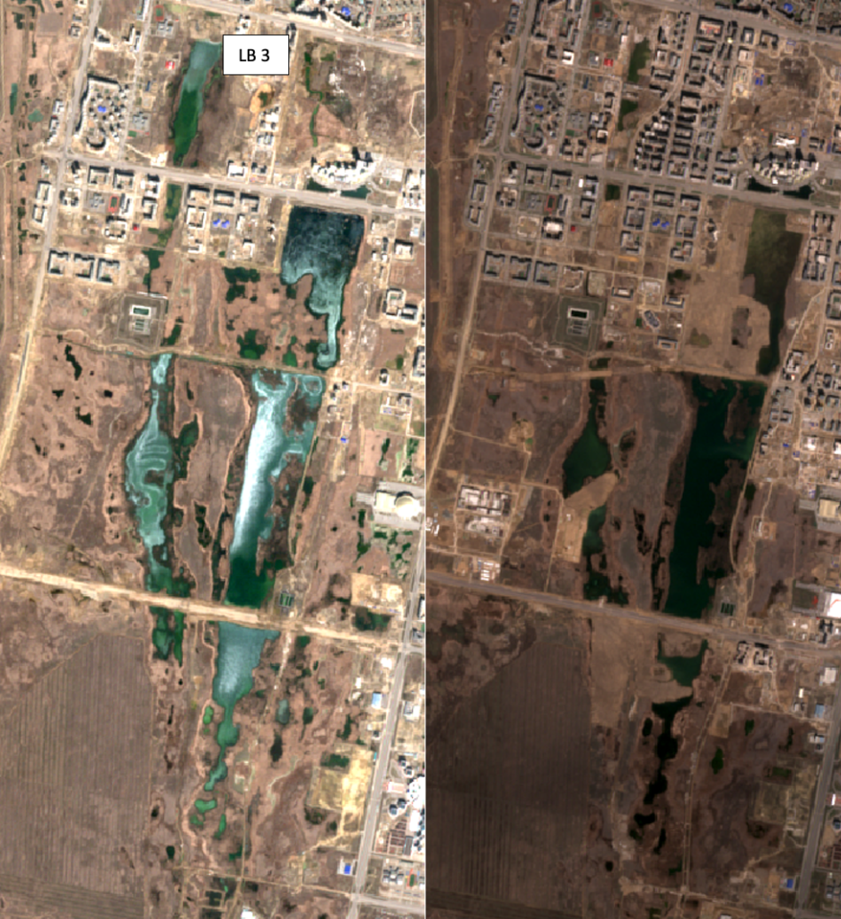
If the last image shows the changes in the last 6 months, the image below illustrates how the LBs shape changed in the last 3 years. The left image below is from 10th of April 2019, the right image below is from the 24th of April 2022. The comparison below clearly demonstrates the scale of land reclamation. Building of residential complexes has significantly decreased the LB3’s surface area (80 % decrease). LB6 now has only 37% of its surface area from April 2019, LB5 61%, LB9 34%, LB4 21%.
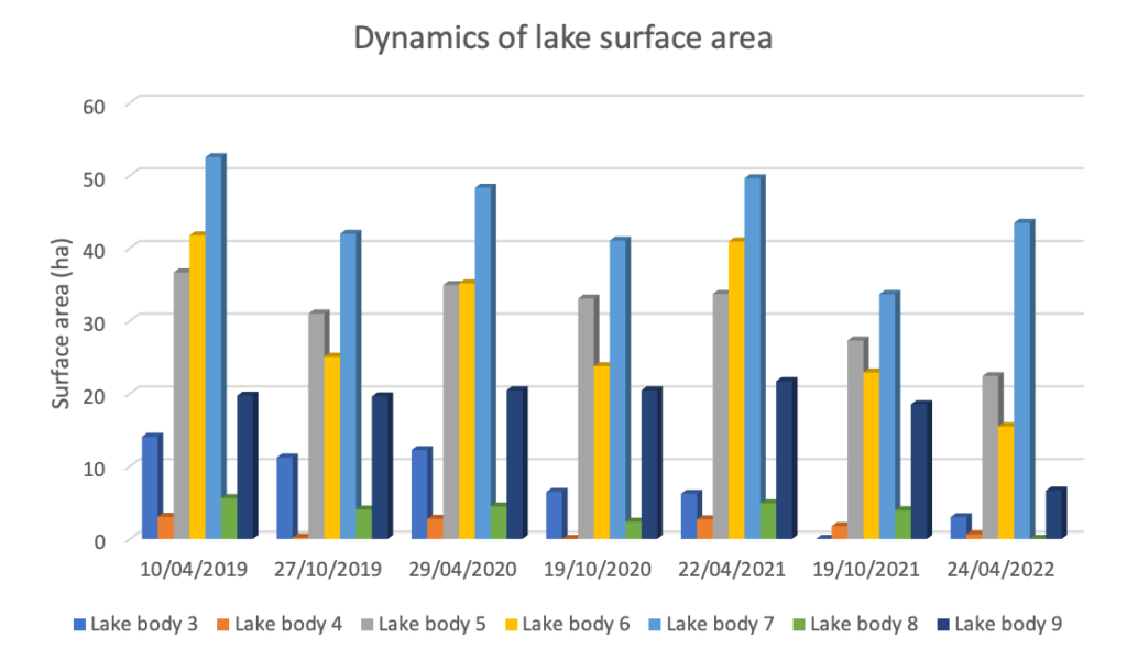
The graph above shows the changes in lake water surface area for the last three years. Sentinel 2 satellite images from April and October of each year were used for this assessment. Each year is characterized by larger surface area in April, which decreases by October. Lower surface area in October is mainly due to evaporation losses from the lake, as lake water is not used/abstracted for any purposes. By April of the next year the surface area of the lakes increases, mainly due to snowmelt and runoff from the nearby areas. This is the annual behavior of this lake system, which was disturbed mainly by anthropogenic activities in the last year or two. As for April 2022 the surface area of the lakes didn’t recover from the decrease in October. There is recovery for LB7, which didn’t undergo much landfilling. While others show decline in surface area, which is the consequence of land filling actions during the cold season. The graph points out that the lakes can lose significant amount of water due to evaporation and more importantly replenish this loss with cold period precipitation.